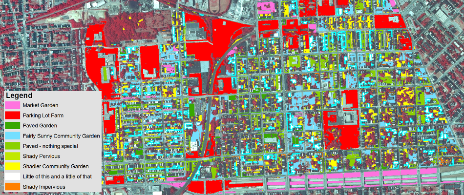
FSRI’s Food System Planning, Mapping, and Inventory Generation services assists all sizes of government, institutions, and business that want to develop and implement successful food system plans, whether they are short-term food procurement goals or long-term planning and zoning modifications or comprehensive regional food system assessments. This includes extensive web mapping capabilities, as shown in these examples.
In an uncertain future challenged by climate change, food insecurity, water shortages, political instability, and energy limitations, communities and businesses will need to take proactive steps to increase resilience to external shocks. FSRI provides food systems planning expertise that will enable you to meet your objectives and minimize your risk exposure.
Is your community hoping to quantify or classify agricultural opportunities? Is part of your business mission to be more committed to the local agricultural economy? Achieve such goals requires the industry insight and knowledge offered by FSRI. For instance, we conduct site specific market analyses and perform feasibility assessments for agricultural production and consumption potential. We also provide strategic and advisory services related to creative farmland preservation, economic development, and potential conflicts between agricultural and non-agricultural uses.
No matter what type of entity you are, these are multidimensional goals influenced by issues of economics, land development pressure, and volatility in global food and energy markets.
The Food Systems Research Institute wants to help you move forward proactively to ensure that your community, business, or institution remains resilient and strong.
